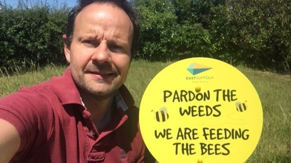
More conservation areas are being created to benefit wildlife as part of East Suffolk Council’s commitment to increase biodiversity areas.
Last year, 40 wild spaces were created across East Suffolk as part of the Council’s ‘Pardon the weeds, we’re feeding the bees’ campaign, where grass was left to grow longer and wildflowers planted to help wildlife thrive. These spaces were cut back for winter and the signs removed but will be returning over the next couple of weeks.
This year, a further 60 wild spaces have been identified, meaning there will now be 100 wild spaces across East Suffolk where grass and wildflowers will be left to grow and the areas will not be cut until the end of the season.
These areas, which are large enough to provide an environmental benefit and do not present any safety issues for local communities, will be marked with our ‘Pardon the weeds, we’re feeding the bees’ signs to make residents and visitors aware.
In addition to creating more conservation areas, East Suffolk Council has also reviewed its policy on herbicide spraying to further encourage and protect local wildlife. As a result, such spraying has already been reduced by 45% across council-owned land and further trials will now be carried out using foam control on unwanted weeds, especially on pavements, to reduce it further.
Cllr James Mallinder, East Suffolk’s cabinet member for the Environment said: “We were really pleased with the positive response we received from residents and visitors last year, with some of our ‘Pardon the weeds, we’re feeding the bees’ signs popping up on social media. This year, we’re creating even more wild spaces and we will now manage these to help wildlife to thrive, through reduced cutting and the sowing of wildflowers.
“We are committed to promoting environmental sustainability and ensure responsible stewardship of our open spaces. By making these small changes, we are hopeful these conservation areas will benefit both wildlife and local people living nearby.”
East Suffolk Council has an ambitious environmental vision to build the right environment for East Suffolk and since declaring a climate emergency in 2019, the Council has expressed its intention to increase the amount of wild spaces in the district, where a more conservation-based approach to cutting could promote biodiversity.
Town and parish councils, supported by East Suffolk Norse, will be monitoring these conservation areas to remove litter and control any invasive plant species. Town and parish councils are also encouraged to contact East Suffolk Council to highlight additional areas which could benefit from a possible change in how they are managed and residents are asked to contact them directly if they have any suggestions for new wild spaces: https://roi.cmis.uk.com/clerkdetails/eastsuffolk
The conservation areas are:
- Beccles St Michaels (churchyard)
- Highleas Close, Beccles (open space)
- Puddingmoor Slopes, Beccles (open space)
- St Mary Paddock, Beccles (open space)
- The Dell, Beccles (open space)
- St Marys Benhall (churchyard)
- Annis Hill Banks, Bungay (highway)
- Beccles Road, Bungay (highway)
- Cemetery, Bungay (cemetery)
- Elizabeth Bonholte Close, Bungay (open space)
- Old cemetery, Bungay (churchyard)
- St. Marys, Bungay (churchyard)
- Trinity, Bungay (churchyard)
- Carlton Park, Carlton Colville (open space)
- All Saints Easton (churchyard)
- Phillips Avenue Felixstowe Paddocks (open space)
- Brook Lane, Framlingham (highway)
- Castle Brook open space, Framlingham (open space)
- The Knoll, Framlingham (highway)
- Vyces Road, Framlingham (highway)
- Halesworth cemetery (cemetery)
- St. Marys, Halesworth (churchyard)
- All Saints Kesgrave (churchyard)
- Grange Farm Ashdale open space banked areas, Kesgrave (open space)
- Grange Farm Pergola Gardens, Kesgrave (open space)
- Grange Farm Ropes Drive underpasses, Kesgrave (open spaces)
- Grange Farm Through Jollys Open Space, Kesgrave (open space)
- St Margarets, Leiston (churchyard)
- Bloodmoor Road, Lowestoft (highway)
- Kirkley cemetery, Lowestoft (cemetery)
- Lowestoft cemetery (cemetery)
- Lowestoft Seafront Slopes (open space)
- Millennium Way, Lowestoft (highway)
- Normanston Drive/Peto Way Roundabout, Lowestoft (highway)
- Peto Way Banks, Lowestoft (highway)
- St Margarets, Lowestoft (churchyard)
- St Peter and St John, Lowestoft (churchyard)
- Old Churchyard, Melton (churchyard)
- St John The Baptist, Saxmundham (churchyard)
- St Marys Earl Soham, Soham (churchyard)
- Church/Hospital Green, Southwold (open space)
- Southwold St Edmunds (churchyard)
- St Peters and St Pauls Aldburgh, St Pauls. Peter (churchyard)
- St Martin & St Mary, Trimly St Martin (churchyard)
- St Marys, Ufford (churchyard)
- Ufford, Yarmouth Road/B1438 (highway)
- St Marys, Walpole (churchyard)
- St Peters, Wenhaston (churchyard)
- All Saints, Wickham Market (churchyard)
- Area behind the swimming pool, Woodbridge (open space)
- Cemetery, Woodbridge (cemetery)
- Collingwood Road, Woodbridge (highway)
- Hillyfields, Woodbridge (highway)
- Lime Kiln Quay, Woodbridge (highway)
- Seckford Hall Road, Woodbridge (highway)
- St Johns, Woodbridge (churchyard)
- St Marys, Woodbridge (churchyard)
- Through Duncans, Woodbridge (highway)
- Portland Crescent, Woodbridge (highway)
- Pepys Avenue, Worlingham (open space)
- Werels Loke, Worlingham (open space)
- St Nicholas, Wrentham (churchyard)
- Wrentham New Cemetery (cemetery)
- Wrentham Old Cemetery (cemetery)
- St Peters, Yoxford (churchyard)


